
Research Update from Summerland Research & Development Center Wine Grape Research. Pat Bowen, Agriculture & Agri-Food Canada. March 2019
GIS Tools for Precision Management
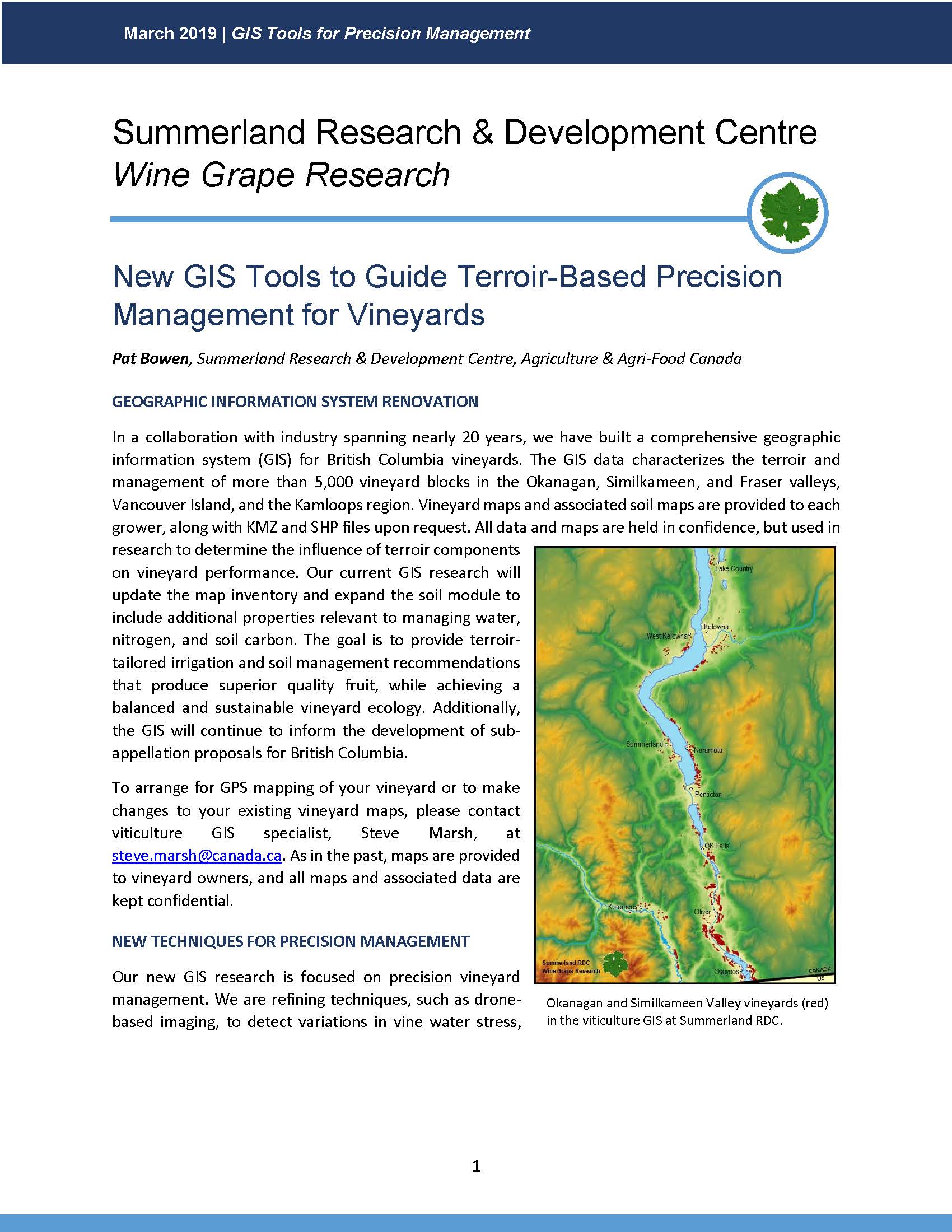
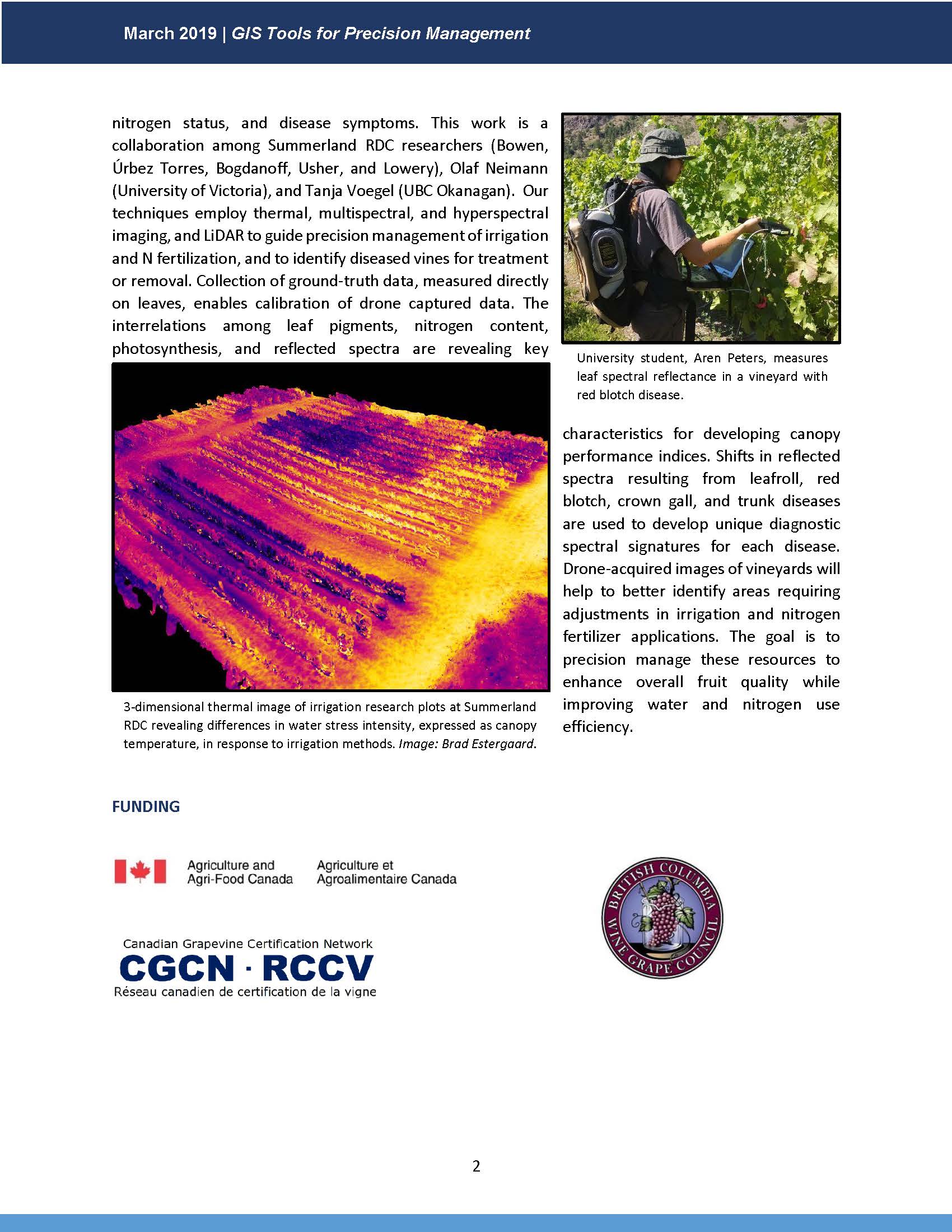
Pat Bowen of Agriculture and Agri-Food Canada discusses drone-based imaging to detect variations in vine water stress, nitrogen status and disease symptoms in her research. Techniques employ thermal, multispectral, and hyperspectral imaging and LiDAR to guide precision management of irrigation and N fertilization, and to identify diseased vines for treatment and removal.
Click to read the full report: GIS Tools for Precision Management